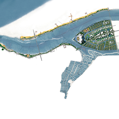
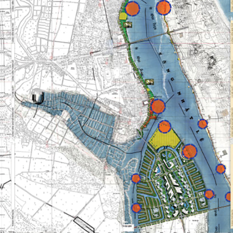
Shores of Nhat Le River Urban planning
- Speciality: Urban Planning Design
- Type: Public
- Year: 2007
- Location: Quang Binh
- Total area: 150 hectares
Quang Binh is a province in the central region of Vietnam, the junction of natural, climactic and socio-economic conditions between the North and the South of the country
It enjoys a favorable geographical position, being located along the most important transportation axis of the country and the region: The 1A route linking Hanoi to Ho Chi Minh City, the 12A route to Laos and then Thailand, the national railway network, the maritime shipping route with the port of Gianh and Hon La, the Chalo international border post, and Dong Hoi airport hosting domestic and international flights
The Nhat Le river is the main river in Quang Binh province. With a length of 85 kilometres, it converges by two main affluent - the Long Dai river passing through Quang Ninh district and the Kien Giang river crossing Le Thuy district - that connect at Trung Quan where the estuary opens to the sea in the city of Dong Hoi

JOIN OUR MAILING LIST